This page contains data recordings of a part of the research project for the Ministry of Transport of the Slovak Republic, which was testing the readiness of Slovak road infrastructure for the deployment of intelligent transportation. To create this dataset, 96 individual routes were conducted on various types of Slovak roads. The roads were selected based on their type or environment, which was the following:
- City – Bratislava – ±13km long route across urban roads in Bratislava,
- Highway – D1 – ±12km long route on a 3-lane highway,
- Highway – D2 – ±32km long route on a 2-lane highway that contains tunnel Sitina with a length of 1415m,
- 1st class – I/61 – ±30km long route on the 1st class road in Bratislava region that contains rural and urban environment,
- 2nd class – II/503 – ±25km long route on a 2nd class road that contains hills and forest,
- 3rd class – various – ±19km long route across several 3rd class roads that contains local rural transportation with limited traffic.
For each type of road, we provide recordings of different weather and light conditions. We used the following methodology when sorting the samples into a specific category:
- Direct sunlight – No atmospheric precipitation, the sky was clear or with low clouds, the sunlight was direct, and objects in the camera’s field of view cast clearly recognizable sharp shadows,
- Normal daylight – No atmospheric precipitation, the sky was completely overcast or with very high cloud cover, sunlight was scattered and objects in the camera’s field of view cast minimal or no shadows,
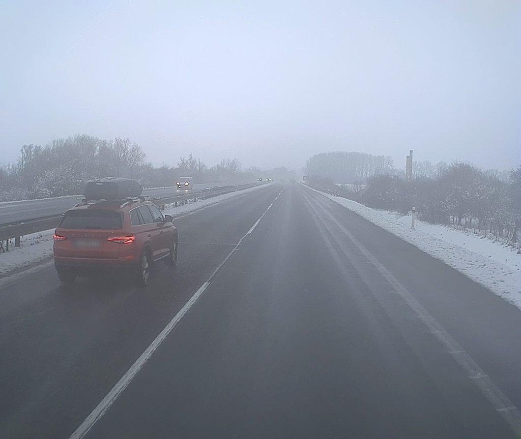
- Rain or fog – Atmospheric precipitation (rain or sleet) or fog was present, resulting in a wet road surface and water condensation on the front camera lens,
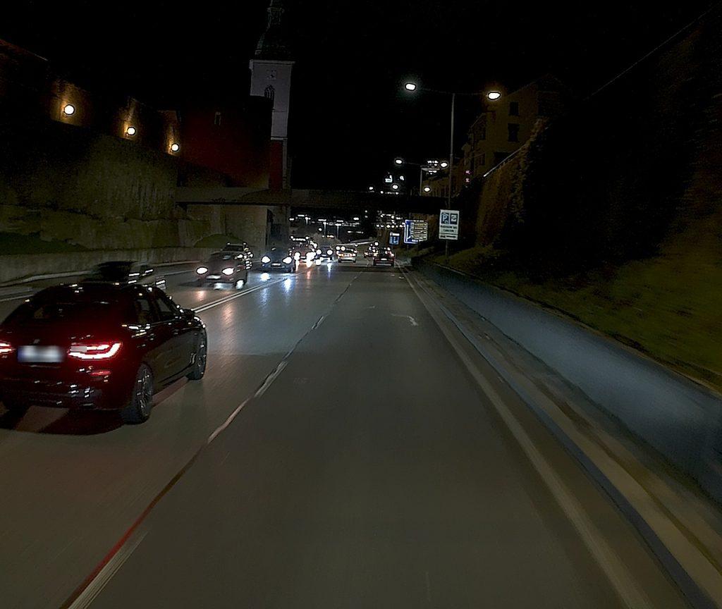
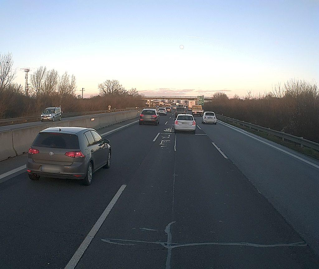
- Dawn or twilight – No atmospheric precipitation, cloud cover was not decisive. The drive was carried out between the beginning of daylight and sunrise above the horizon, or between sunset below the horizon and the time of complete darkness.
Usage policy
All datasets and benchmarks on this page are copyright by us and published under the Creative Commons Attribution 4.0 (CC BY 4.0) license. This means that you must attribute the work in the manner specified by the authors, you may not use this work for commercial purposes and if you alter, transform, or build upon this work, you may distribute the resulting work only under the same license.
When using this dataset, please cite following research paper:
Galinski, M., Milesich, T., Janeba, M. et al. Camera and telemetry data from Slovak roads in various light and weather conditions. Sci Data 11, 1450 (2024). https://doi.org/10.1038/s41597-024-04276-y
Sensor Setup
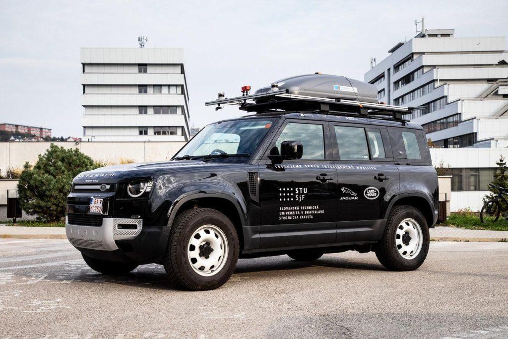
On this section, we provide information regarding the recording platform and sensor configuration utilized for capturing this dataset. For all drives, Land Rover Defender equipped with an AIL System Solution rooftop box, which is a custom-built proprietary solution of the Automotive Innovation Lab research laboratory at STU. We used following sensors in rooftop box for data recording:
Front camera
For recording of camera frames we used D3RCM-OV10640-953 rugged camera module by DesignCoreTM with 1.3 MegaPixel and FPD-LinkTM III interface. This camera suits automotive and industrial production needs. The lens Sunny 4083 provides 52 degree horizontal field of view (FOV) with aperture of 1.6 and 6.14 mm focal length. The resolution of each frame is 1280 × 1080, meaning the frames are in 4:3 ratio.
GNSS Sensor
The GNSS development kit from the company U-blox C102 – F9R is a device for determining high-precision position. The module has the option of connecting a dual-band external antenna, which together with Real-Time Kinematics (RTK) over the Internet Protocol using NTRIPv3 can ensure the fixed accuracy of the position.
Mobile network modem
A network modem and router, Teltonika RUTX50, that provides connection to 2G, 3G, 4G (LTE) and 5G NSA mobile network. The device has a modem that supports all transmission bands of mobile operators used in the territory of the Slovak Republic.


Data Description
We offer four recordings in ZIP format for each combination of road type and weather or light conditions. Each recorded route includes the following data:
- Processed (anonymized) color video images (stored in JPG format)
- Raw data from GNSS and Mobile network modem (latitude, longitude, height above mean sea level, ggs, gc, horizontal accuracy, satellite, ping, download speed, upload speed, internet mode, stored in CSV format)
- Road lane detection data (name of the video frame, number of detecting lanes, points of the detected lane, length of the detected lane, stored in JSON and CSV format)
- Roadsigns detection data (name of video frame, category of roadsign, probability score, x and y coordinates of detected roadsign, stored in JSON and CSV format)
Examples
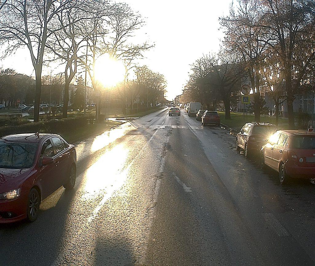
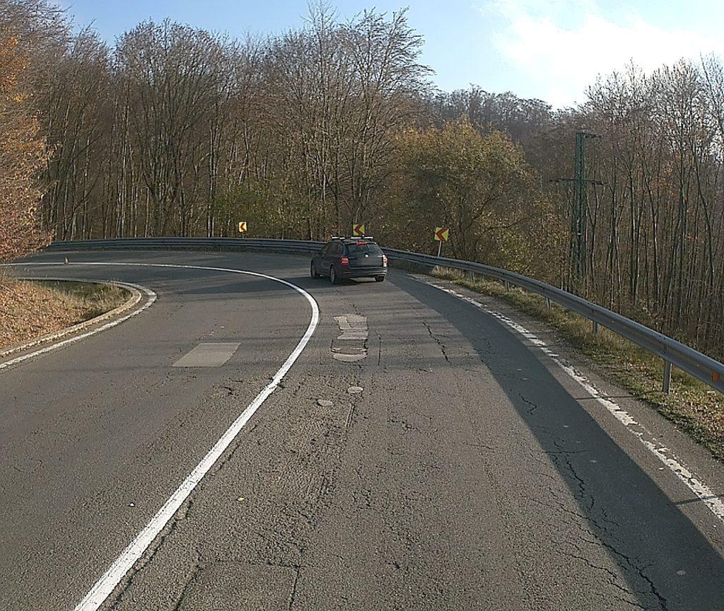
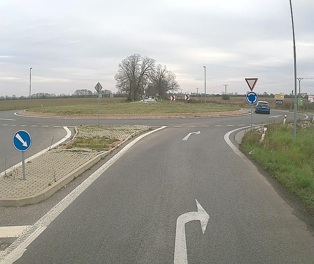
Here, we provide illustrative examples of video frames from various datasets, each representing different road types and environmental conditions.
Privacy statement
Important: The recorded videos are anonymized using a program that has obfuscated license plates and individuals on the roads. However, it’s possible that not all videos have been anonymized, and some video frames might still raise privacy concerns. If you have any issues regarding non-anonymized video frames or potential privacy breaches, please don’t hesitate to contact our team.
In case of interest, it is possible to make available the non-anonymized and non-preprocessed version of the dataset by mutual agreement.
Downloadable Datasets
-
C1
-
C2
-
C3
-
City
-
D1
-
D2
- 21-11_14_50_direct_light
Lenght: 52917 frames
Size: 25,9 GB
Download: 21-11_14_50_direct_light.zip - 25-11_09_35_direct_light
Lenght: 49806 frames
Size: 31,1 GB
Download: 25-11_09_35_direct_light.zip - 25-11_12_52_direct_light
Lenght: 53541 frames
Size: 29,0 GB
Download: 25-11_12_52_direct_light.zip - 05-01_15-14_direct_light
Lenght: 48170 frames
Size: 23,0 GB
Download: 05-01_15_14_direct_light.zip - 19-11_11_04_normal_light
Lenght: 49066 frames
Size: 26,3 GB
Download: 19-11_11_04_normal_light.zip - 24-11_15_23_normal_light
Lenght: 53146 frames
Size: 27,2 GB
Download: 24-11_15_23_normal_light.zip - 05-01_08_05_normal_light
Lenght: 52141 frames
Size: 26,4 GB
Download: 05-01_08_05_normal_light.zip - 19-01_09_47_normal_light
Lenght: 52491 frames
Size: 30,7 GB
Download: 19-01_09_47_normal_light.zip - 04-01_11_40_rain
Lenght: 49601 frames
Size: 12,2 GB
Download: 04-01_11_40_rain.zip - 04-01_14_57_rain
Lenght: 52391 frames
Size: 12,0 GB
Download: 04-01_14_57_rain.zip - 05-01_12_18_rain
Lenght: 48407 frames
Size: 21,8 GB
Download: 05-01_12_18_rain.zip - 22-01_10_47_rain
Lenght: 49729 frames
Size: 17,8 GB
Download: 22-01_10_47_rain.zip - 14-11_16_06_twilight
Lenght: 58721 frames
Size: 24,2 GB
Download: 14-11_16_06_twilight.zip - 25-11_16_24_twilight
Lenght: 56396 frames
Size: 17,9 GB
Download: 25-11_16_24_twilight.zip - 05-01_16_16_twilight
Lenght: 51460 frames
Size: 21,3 GB
Download: 05-01_16_16_twilight.zip - 06-01_16_14_twilight
Lenght: 48405 frames
Size: 20,9 GB
Download: 06-01_16_14_twilight.zip
- 14-11_13_08_direct_light
Lenght: 44431 frames
Size: 32,6 GB
Download: 14-11_13_08_direct_light.zip - 25-11_11_46_direct_light
Lenght: 49528 frames
Size: 35,3 GB
Download: 25-11_11_46_direct_light.zip - 25-11_15_06_direct_light
Lenght: 66281 frames
Size: 44,6 GB
Download: 25-11_15_06_direct_light.zip - 07-01_15_15_direct_light
Lenght: 41566 frames
Size: 27,3 GB
Download: 07-01_15_15_direct_light.zip - 19-11_10_12_normal_light
Lenght: 44811 frames
Size: 30,9 GB
Download: 19-11_10_12_normal_light.zip - 21-11_13_56_normal_light
Lenght: 47771 frames
Size: 31,1 GB
Download: 21-11_13_56_normal_light.zip - 04-01_13_12_normal_light
Lenght: 41923 frames
Size: 30,9 GB
Download: 04-01_13_12_normal_light.zip - 05-01_13_59_normal_light
Lenght: 45219 frames
Size: 28,1 GB
Download: 05-01_13_59_normal_light.zip - 18-11_13_31_rain
Lenght: 32357 frames
Size: 27,5 GB
Download: 18-11_13_31_rain.zip - 04-01_10_40_rain
Lenght: 43152 frames
Size: 31,4 GB
Download: 04-01_10_40_rain.zip - 05-01_11_17_rain
Lenght: 42821 frames
Size: 14,6 GB
Download: 05-01_11_17_rain.zip - 22-01_09_52_rain
Lenght: 58692 frames
Size: 23,5 GB
Download: 22-01_09_52_rain.zip - 21-11_16_10_twilight
Lenght: 47556 frames
Size: 14,8 GB
Download: 21-11_16_10_twilight.zip - 05-01_07_10_twilight
Lenght: 43236 frames
Size: 11,5 GB
Download: 05-01_07_10_twilight.zip - 06-01_07_12_twilight
Lenght: 40871 frames
Size: 15,2 GB
Download: 06-01_07_12_twilight.zip - 07-01_16_31_twilight
Lenght: 45104 frames
Size: 11,4 GB
Download: 07-01_16_31_twilight.zip
- 14-11_15_39_direct_light
Lenght: 39088 frames
Size: 21,0 GB
Download: 14-11_15_39_direct_light.zip - 25-11_09_04_direct_light
Lenght: 36401 frames
Size: 23,2 GB
Download: 25-11_09_04_direct_light.zip - 25-11_12_26_direct_light
Lenght: 34491 frames
Size: 21,6 GB
Download: 25-11_12_26_direct_light.zip - 05-01_14_46_direct_light
Lenght: 36391 frames
Size: 21,5 GB
Download: 05-01_14_46_direct_light.zip - 18-11_14_09_normal_light
Lenght: 37976 frames
Size: 21,6 GB
Download: 18-11_14_09_normal_light.zip - 19-11_10_39_normal_light
Lenght: 35166 frames
Size: 22,8 GB
Download: 19-11_10_39_normal_light.zip - 21-11_14_26_normal_light
Lenght: 35336 frames
Size: 20,6 GB
Download: 21-11_14_26_normal_light.zip - 07-01_13_07_normal_light
Lenght: 36146 frames
Size: 24,4 GB
Download: 07-01_13_07_normal_light.zip - 04-01_11_13_rain
Lenght: 35307 frames
Size: 07,1 GB
Download: 04-01_11_13_rain.zip - 04-01_14_31_rain
Lenght: 35636 frames
Size: 10,8 GB
Download: 04-01_14_31_rain.zip - 05-01_11_55_rain
Lenght: 34547 frames
Size: 18,8 GB
Download: 05-01_11_55_rain.zip - 06-01_15_15_rain
Lenght: 35569 frames
Size: 22,7 GB
Download: 06-01_15_15_rain.zip - 21-11_16_30_twilight
Lenght: 37131 frames
Size: 07,6 GB
Download: 21-11_16_30_twilight.zip - 25-11_15_54_twilight
Lenght: 38736 frames
Size: 18,1 GB
Download: 25-11_15_54_twilight.zip - 05-01_07_37_twilight
Lenght: 38398 frames
Size: 18,4 GB
Download: 05-01_07_37_twilight.zip - 06-01_07_37_twilight
Lenght: 33886 frames
Size: 19,0 GB
Download: 06-01_07_37_twilight.zip
- 25-11_14_11_direct_light
Lenght: 51491 frames
Size: 31,0 GB
Download: 25-11_14_11_direct_light.zip - 04-01_12_32_direct_light
Lenght: 42864 frames
Size: 27,9 GB
Download: 04-01_12_32_direct_light.zip - 07-01_13_54_direct_light
Lenght: 40221 frames
Size: 25,8 GB
Download: 07-01_13_54_direct_light.zip - 07-01_14_27_direct_light
Lenght: 37209 frames
Size: 23,5 GB
Download: 07-01_14_27_direct_light.zip - 05-01_09_09_normal_light
Lenght: 44120 frames
Size: 25,8 GB
Download: 05-01_09_09_normal_light.zip - 05-01_09_46_normal_light
Lenght: 41361 frames
Size: 23,7 GB
Download: 05-01_09_46_normal_light.zip - 05-01_10_22_normal_light
Lenght: 43966 frames
Size: 24,5 GB
Download: 05-01_10_22_normal_light.zip - 05-01_13_12_normal_light
Lenght: 45816 frames
Size: 24,5 GB
Download: 05-01_13_12_normal_light.zip - 04-01_15_30_rain
Lenght: 44261 frames
Size: 24,1 GB
Download: 04-01_15_30_rain.zip - 22-01_13_35_rain
Lenght: 38466 frames
Size: 11,9 GB
Download: 22-01_13_35_rain.zip - 22-01_14_10_rain
Lenght: 37340 frames
Size: 11,4 GB
Download: 22-01_14_10_rain.zip - 22-01_14_45_rain
Lenght: 39602 frames
Size: 18,0 GB
Download: 22-01_14_45_rain.zip - 18-11_15_47_twilight.zip
Lenght: 47146 frames
Size: 20,5 GB
Download: 18-11_15_47_twilight.zip.zip - 04-01_16_21_twilight
Lenght: 43504 frames
Size: 14,8 GB
Download: 04-01_16_21_twilight.zip - 05-01_17_04_twilight
Lenght: 46388 frames
Size: 17,1 GB
Download: 05-01_17_04_twilight.zip - 06-01_17_02_twilight
Lenght: 39051 frames
Size: 13,5 GB
Download: 06-01_17_02_twilight.zip
- 25-11_10_07_direct_light
Lenght: 11675 frames
Size: 06,1 GB
Download: 25-11_10_07_direct_light.zip - 25-11_13_25_direct_light
Lenght: 11416 frames
Size: 06,1 GB
Download: 25-11_13_25_direct_light.zip - 05-01_15_45_direct_light
Lenght: 11572 frames
Size: 04,5 GB
Download: 05-01_15_45_direct_light.zip - 06-01_14_52_direct_light
Lenght: 11674 frames
Size: 05,9 GB
Download: 06-01_14_52_direct_light.zip - 18-11_15_24_normal_light
Lenght: 12459 frames
Size: 04,1 GB
Download: 18-11_15_24_normal_light.zip - 19-11_11_33_normal_light
Lenght: 11834 frames
Size: 05,2 GB
Download: 19-11_11_33_normal_light.zip - 24-11_14_56_normal_light
Lenght: 11842 frames
Size: 03,9 GB
Download: 24-11_14_56_normal_light.zip - 04-01_12_11_normal_light
Lenght: 11855 frames
Size: 05,4 GB
Download: 04-01_12_11_normal_light.zip - 22-01_11_21_rain
Lenght: 11493 frames
Size: 03,0 GB
Download: 22-01_11_21_rain.zip - 22-01_11_39_rain
Lenght: 11186 frames
Size: 02,9 GB
Download: 22-01_11_39_rain.zip - 22-01_12_03_rain
Lenght: 10928 frames
Size: 03,0 GB
Download: 22-01_12_03_rain.zip - 22-01_12_37_rain
Lenght: 11097 frames
Size: 03,1 GB
Download: 22-01_12_37_rain.zip - 14-11_16_41_twilight
Lenght: 13560 frames
Size: 03,9 GB
Download: 14-11_16_41_twilight.zip - 25-11_16_59_twilight
Lenght: 12294 frames
Size: 01,7 GB
Download: 25-11_16_59_twilight.zip - 05-01_16_47_twilight
Lenght: 11698 frames
Size: 03,3 GB
Download: 05-01_16_47_twilight.zip - 06-01_16_44_twilight
Lenght: 11542 frames
Size: 04,1 GB
Download: 06-01_16_44_twilight.zip
- 25-11_11_27_direct_light
Lenght: 30001 frames
Size: 16,6 GB
Download: 25-11_11_27_direct_light.zip - 25-11_14_43_direct_light
Lenght: 32306 frames
Size: 15,3 GB
Download: 25-11_14_43_direct_light.zip - 04-01_10_22_direct_light
Lenght: 31351 frames
Size: 16,5 GB
Download: 04-01_10_22_direct_light.zip - 04-01_12_54_direct_light
Lenght: 32333 frames
Size: 17,8 GB
Download: 04-01_12_54_direct_light.zip - 19-11_09_39_normal_light
Lenght: 30446 frames
Size: 14,5 GB
Download: 19-11_09_39_normal_light.zip - 21-11_13_40_normal_light
Lenght: 30301 frames
Size: 14,1 GB
Download: 21-11_13_40_normal_light.zip - 21-11_15_53_normal_light
Lenght: 31126 frames
Size: 11,6 GB
Download: 21-11_15_53_normal_light.zip - 05-01_13_42_normal_light
Lenght: 30251 frames
Size: 14,4 GB
Download: 05-01_13_42_normal_light.zip - 18-11_13_14_rain
Lenght: 30841 frames
Size: 08,4 GB
Download: 18-11_13_14_rain.zip - 05-01_11_00_rain
Lenght: 31213 frames
Size: 08,0 GB
Download: 05-01_11_00_rain.zip - 22-01_15_08_rain
Lenght: 30299 frames
Size: 08,7 GB
Download: 22-01_15_08_rain.zip - 22-01_15_53_rain
Lenght: 29171 frames
Size: 08,4 GB
Download: 22-01_15_53_rain.zip - 05-01_06_53_twilight
Lenght: 29385 frames
Size: 04,7 GB
Download: 05-01_06_53_twilight.zip - 06-01_06_57_twilight
Lenght: 28788 frames
Size: 06,8 GB
Download: 06-01_06_57_twilight.zip - 07-01_16_14_twilight
Lenght: 30035 frames
Size: 09,9 GB
Download: 07-01_16_14_twilight.zip - 19-01_16_47_twilight
Lenght: 30501 frames
Size: 07,1 GB
Download: 19-01_16_47_twilight.zip
